![[Back]](../../../images/back.gif "[Back]") |
Index | ![[Next]](../../../images/next-red.gif) |
The City of Hoboken, in partnership with the Port Authority transformed 50 acres of unused waterfront property into a unique commercial, residential and recreational area that will provide thousands of new jobs and significant economic growth while ensuring public access to the waterfront and much needed recreational space.
 |
 |
| The Hoboken South Waterfront development combines all the elements of smart growth - mixed-use development, new green spaces and public transportation. Photo: Image Up Studio: Metuchen, NJ | Model of Fund for a Better Waterfront plan for the Hoboken waterfront. Photo: Fund for a Better Waterfront |
In addition to the residential development, the overall plan calls for a minimum of 1.5 million square feet of commercial office space, a 300-room hotel, a total of 125,000 square feet of retail and more than seven acres of recreational open space. The Port Authority has provided funds for land purchases, open space and public infrastructure improvements. The newly designed Pier A Park alone, has increased Hoboken's open space inventory by 40%.
The plan combines all the elements of smart growth -- mixed-use development, new green spaces, public transportation and community involvement. Residents will be able to live and work within the project, or use the nearby light rail or PATH train to commute to jobs in Hoboken's center, other parts of New Jersey or New York City. In addition, the project offers easy access to bus and ferry service.
The project is also well located. Adjacent to a college and with access to libraries, government buildings and a community center, residents can stay involved without driving all around town. The streets inside Hoboken South Waterfront are also designed to be pedestrian- and bicycle-friendly. Crosswalks, lights and wide sidewalks make travel on foot enjoyable, while amenities for bikes -- including bike lanes and bike racks -- will make cycling easier and safer.
 |
 |
| View Looking East-Northeast at the New Fishing Pier.Photo: S.T. Hudson Engineers Inc. | View Looking South from the New Fishing Pier. Photo: S.T. Hudson Engineers Inc. |
The redevelopment plan for Hoboken's waterfront provides a model to emulate both in terms of its design principles and the importance of citizen participation. The plan strikes a balance between new development and new public open space along the waterfront and adheres to traditional scale and character, extending Hoboken's signature 200 by 400 foot grid, carefully controlling building mass and requiring articulated building facades. The redevelopment of idle industrial waterfronts such as Hoboken's offers significant opportunities to redress some of the limitations of older industrial areas, which were developed in ways that typically precluded public access to the waterfront and provided little public open space.
 |
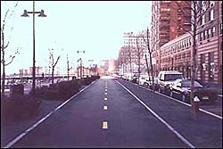 |
| Hoboken's Sinatra Waterfront Park Photo: NJ Department of Environmental Protection | Hoboken Waterfront Bike Path Photo: Kenneth S. Roberts |
More Info
Visit the official City of Hoboken Web site (www.hobokennj.org) where you can learn more about this waterfront development, including viewing a movie virtual tour.
|
Index | |